When you look at the photograph of the path down to the Smithy Gate entrance it is hard to imagine that until 1804 this was part of the main road between York and Chester.

The road came up from Smith Lodge, past the point where this photograph was taken, and continued down to Heaton Gate, which was located somewhere a little higher up than the tram museum, then onwards to Bowker Bank.
The road was known as the Heywood Turnpike, or sometimes the Crumpsall Turnpike, with a toll house near Blackley Lane. Turnpikes were a means of improving roads in the 18th century, with local investors, usually landowners, paying to improve and maintain the roads, then being reimbursed by collecting tolls from travellers. The chief, perhaps sole, investor in the Crumpsall Turnpike was Sir Thomas Egerton. In a March 1778 he wrote from London to his agent, Willam Rogers, ‘The interest from the Crumpsall Turnpike is now due. I wish you would call upon Mr. Tunnerdine (his Manchester lawyer) and receive it from him, and get a bill of short date and send it to me.’
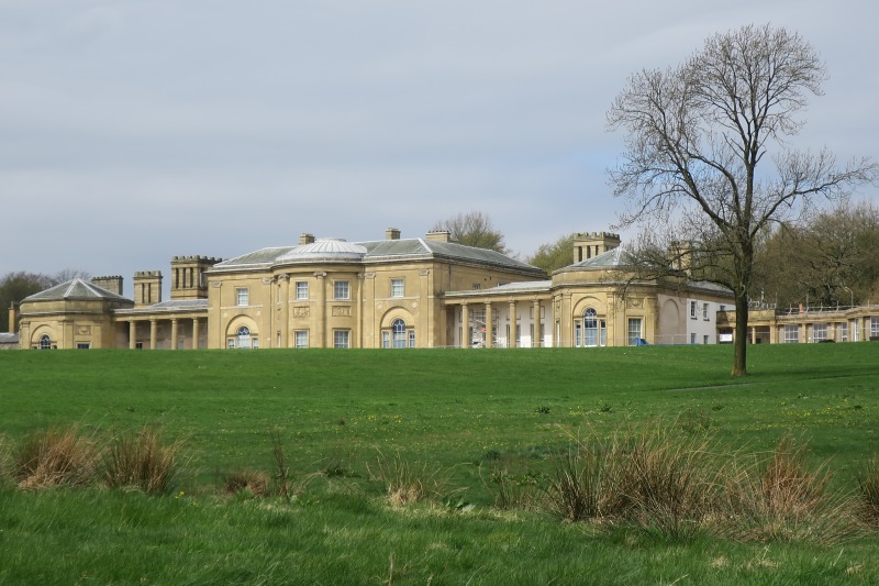
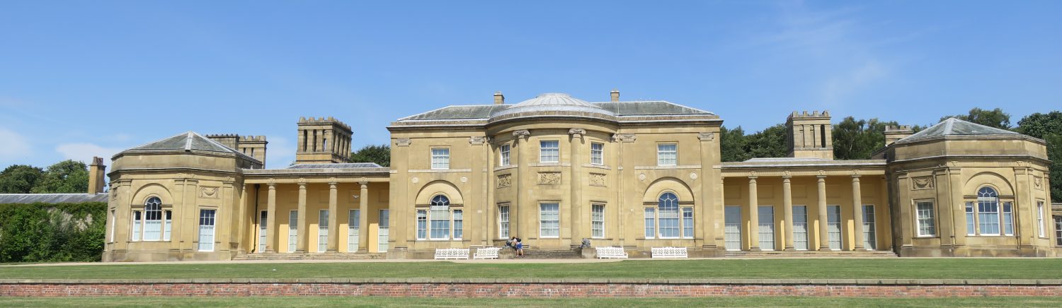
Travellers along the road would have had this view of Heaton Hall, but from as early as 1777 Sir Thomas had it in mind to divert the course of the road and move it out of sight of the Hall. A survey was made in that year, and a map produced, showing the proposed line of the new roads, but nothing other was done until 1783 when the map was submitted to the Manchester Court of Quarter Sessions, as a result of which the following was added in the blank half of the map;
‘We Richard Towneley and James Bradshaw Esquires two of His Majesty’s Justices of the Peace ….. having upon view found that a certain part of an ancient pack and prime otherwise a horse and foot or drift highway within the Parish of Prestwich ….. through the grounds of Sir Thomas Egerton of Heaton House ….. may be diverted and turned so as to make the same more commodious to the public ….. having received the consent of Sir Thomas to the said new highway being made through his land ….. and do so order that the same shall be done by and at the expense of Sir Thomas Egerton who has been accustomed to repair and mend the said … highway.’
Although legal permission to divert the road had been given, construction work did not begin until 1799, by which time Sir Thomas had become, first Lord Grey de Wilton, then the Earl of Wilton. Work on the new highway was completed in 1803, at which time it was officially inspected and given legal approval.
‘We the undersigned being Justices of the Peace …. having this day viewed a certain diversion of the Turnpike Road from Manchester to Rochdale, such diversion commencing at or near the Three Mile Stone at Bowker Bank and extending thence to or near the Toll Gate at Blackley Lane end and having also viewed the continuation of a certain lane or way called Sheepfoot Lane into the new line of the road made by such diversion Do hereby certify that the diversion and continuation are made and completed according to the agreement made between the Trustees acting within and for the Manchester District of the said Turnpike road and the Right Honourable Earl of Wilton (late Lord Grey de Wilton) at a meeting of the said Trustees held at the Griffin at Cheetham Hill on the 21st January 1799 and entered in the order book of the said Trustees which order book is now produced and read to us and the plan there referred to also exhibited to us and given under our hands the twenty second day of September one thousand eight hundred and three.’
The line of the new road is that stretch of Middleton Road running between the M60 and Bowker Bank (much of which has been widened considerably since 1803). The lower half of Sheepfoot Lane was also constructed at that time as part of the work.
One other road was included in the diversion work. The Bridle Path, and its continuation, Whittaker Lane, was the route from the old main road to Prestwich Parish Church, but that part which lay within Heaton Park (now the road up to the gate at Heaton Park Station) was diverted to go round the northern boundary of the park, continuing from Old Hall Lane to St. Mary’s Road. When the reservoir was built in the early 1900s the Bridle Lane was diverted yet again, to come out on Heywood Road on the way to Simister.
It was after the diversion of these roads that the wall around Heaton Park was built.

Very information and gives an insight into the historical background to the environmental development.